Wonders of the Faroe Islands
Unpolished nature, scenic views from the hilly terrain and water virtually no matter which way you look - the Faroe Islands offer a sea of unforgettable and breathtaking natural experiences, and often the drive there is as great an experience as the attraction itself. Rent a car from Budget and drive off into the blue. It's not cars that take up the most space in the landscape, but you may have to hold back for a sheep or two when you drive out there to enjoy the many wonders of nature in the Faroe Islands.
The optical illusion
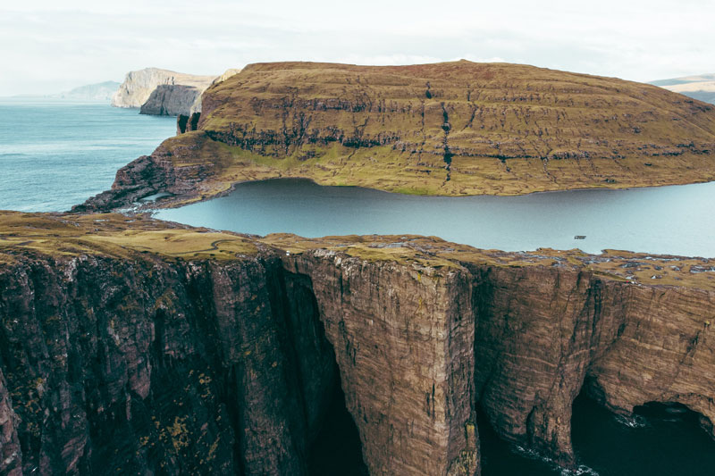
One of the most popular attractions in the beautiful Faroese nature is the lake Sørvágsvatn or Leitisvatn, which is located on the southern part of the island of Vágar. The lake is 32 meters above sea level, but the cliff between the lake and the sea is 100 meters high, so from a certain angle the distance seems even greater. The locals do not quite agree on the name of the lake. The inhabitants of Sørvágur have named the lake after their village, while the inhabitants of Miðvágur on the other side of the lake call it Leitisvatn, after the lake's eastern shore Leiti. However, everyone can agree that the lake is a spectacular sight, topped only by the equally spectacular waterfall Bøsdalafossur, which flows from the lake and directly into the sea.
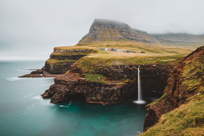
The waterfall at Gásadalur
Múlafossur waterfall is another wonder created by mother nature that requires a stop on the way. The water flows below the small settlement of Gásadalur, which is on the edge of the island of Vágar with the mountain on one side and the most beautiful view out over the water to the other side, from where the waterfall Múlafossur flows over the cliff and into the water. The iconic sight became easier to enjoy in 2004 when a tunnel connection to Gásadalur was built. Before the tunnel was made, you had to park on the other side of the mountain and walk the last distance to the charming village.
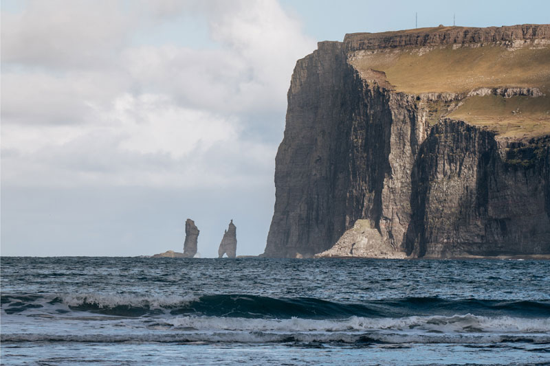
The Giant and the Witch
At the town of Tjørnuvík, which is located on the Faroe Islands' second-largest island, two impressive rock formations of 68 and 71 meters respectively rise out of the water. The legend says that it is two Icelandic giants named Risin and Kellingin (the giant and the bitch) who had been sent to draw the Faroe Islands closer to Iceland. However, it turned out to be more difficult than they thought, and the two giants were so busy that they did not notice the sunrise. As soon as the first rays of the sun hit the two giants, they turned to stone - and they have been looking longingly out to sea ever since. Just before you reach the town of Tjørnuvík, you can also spot Fóssa, the Faroe Islands' highest waterfall.
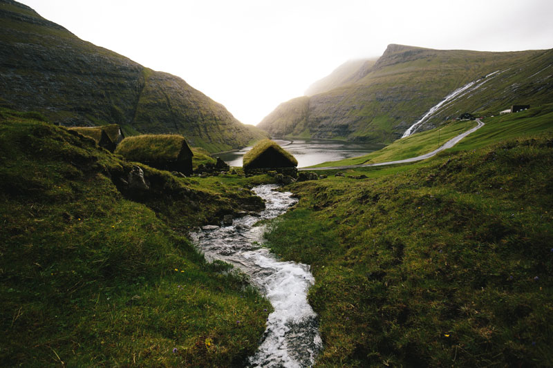
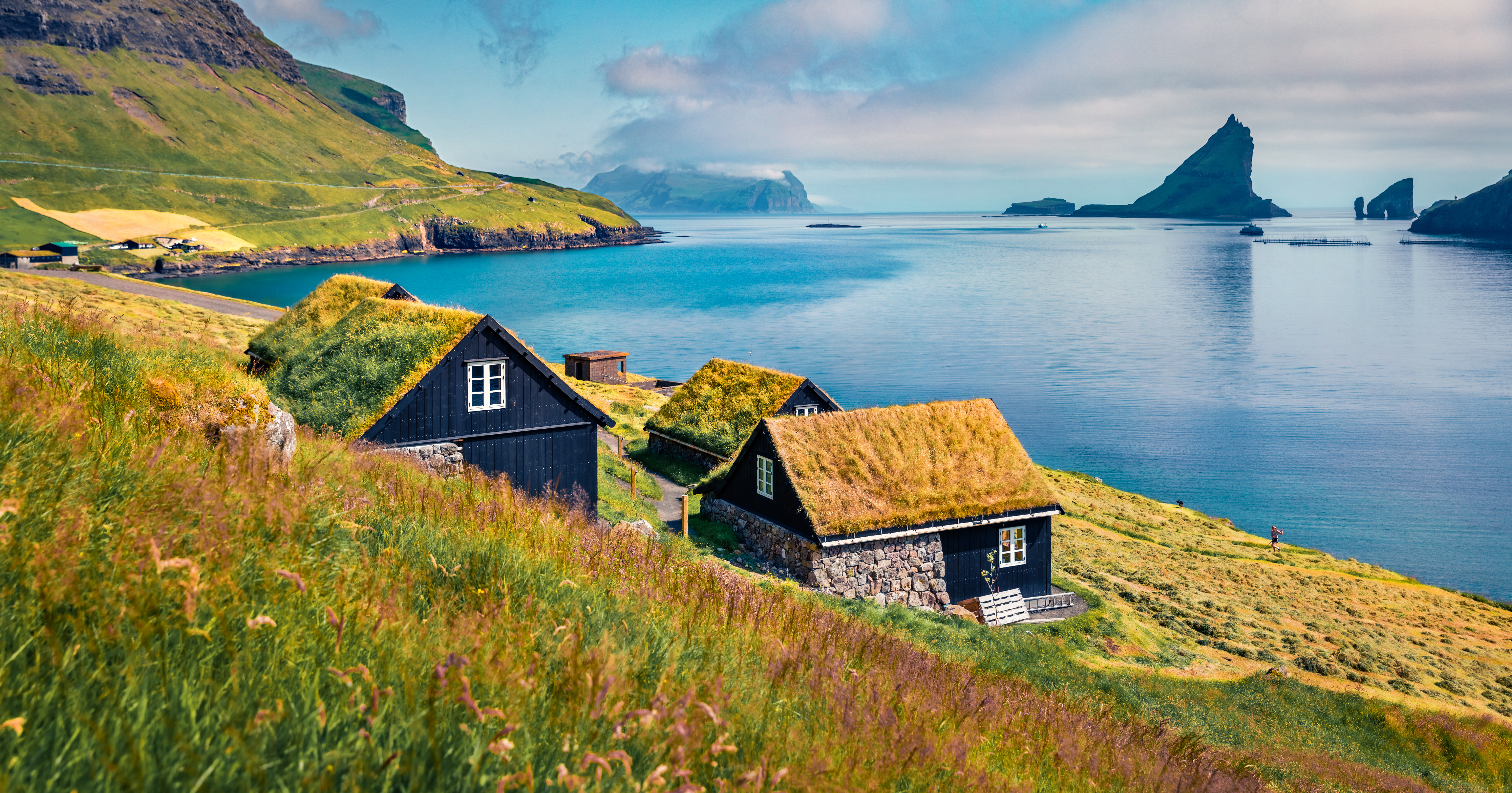
Picturesque Saksun
A little north of Tórshavn you will find the natural gem Saksun, which is also a favorite among the locals - perhaps because of the very special peace and quiet that cannot be found anywhere else. The picturesque little village is located in the valley of Saksunardalur and consists of a cluster of stone houses with grass on the roof and a small white church. The settlement is something very special because it lies at the bottom of what was once a narrow fjord, and at the foot of the settlement lies a lagoon. If it's low tide, you can enjoy an unforgettable walk from the village all the way to the sea - but be aware of the tide.
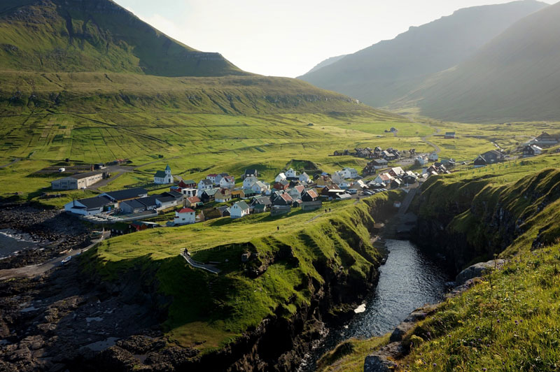
The natural harbor in Gjógv
The small settlement of Gjógv is located on Eysturoy, the second largest island in the Faroe Islands, and is a good example of how magnificent nature can be. Gjógv is located by a natural rocky gorge, which functions as a small natural harbor that is protected from wind and weather. To the left of the harbor there is a path up the mountain where you can enjoy the fresh air and the view over the island of Kalsoy, the bird life and the beautiful rocks. Not only is it a great experience to see the beautiful settlement - the trip there is one of the most beautiful stretches with hairpin turns that also takes you past the Faroe Islands' highest mountain Slætteratindur.
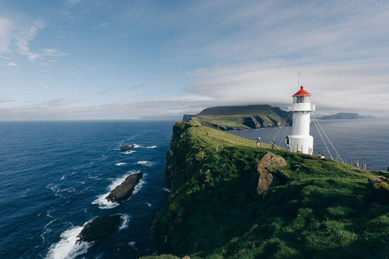
Magic Mykines
A trip to the Faroe Islands is not complete without a trip to the remote island of Mykines, which is the westernmost point of the archipelago. Enjoy the beautiful drive to the port of Sørvágur, located on the island of Vágar, from where you can sail to Mykines in 45 minutes. Mykines is especially known for its absolutely fantastic nature, the beautiful lighthouse and a rich bird life. The island is a true paradise for both bird lovers and the island's large bird population. Here you will find a colony of charming puffins, characterized by their mournful eyes and colorful beaks.
Sub-sea tunnels
The sub-sea tunnels link a large part of the Faroe Islands together.
Vágatunnilin connects the western island Vágar, where the Airport is located, to the central island Streymoy, where the capital Tórshavn is located.
The 4,9 km long Vágar tunnel opened for traffic in December 2002 and was the first sub-sea tunnel on the Faroe Islands. If you arrive by plane and plan on visiting other islands besides Vágar, you will need to drive through this tunnel.
Norðoyatunnilin connects the northern island Borðoy, where Klaksvík is located, to the eastern island Eysturoy, where you will find several top attractions such as Gjógv, Tjørnuvík and many more.
The Norðoya tunnel is 6,2 km long. It was the second sub-sea tunnel and opened for traffic in April 2006. Eysturoyartunnilin opened as the third in December 2020 and links central Streymoy and eastern Eysturoy with a total length of 11,4 km.
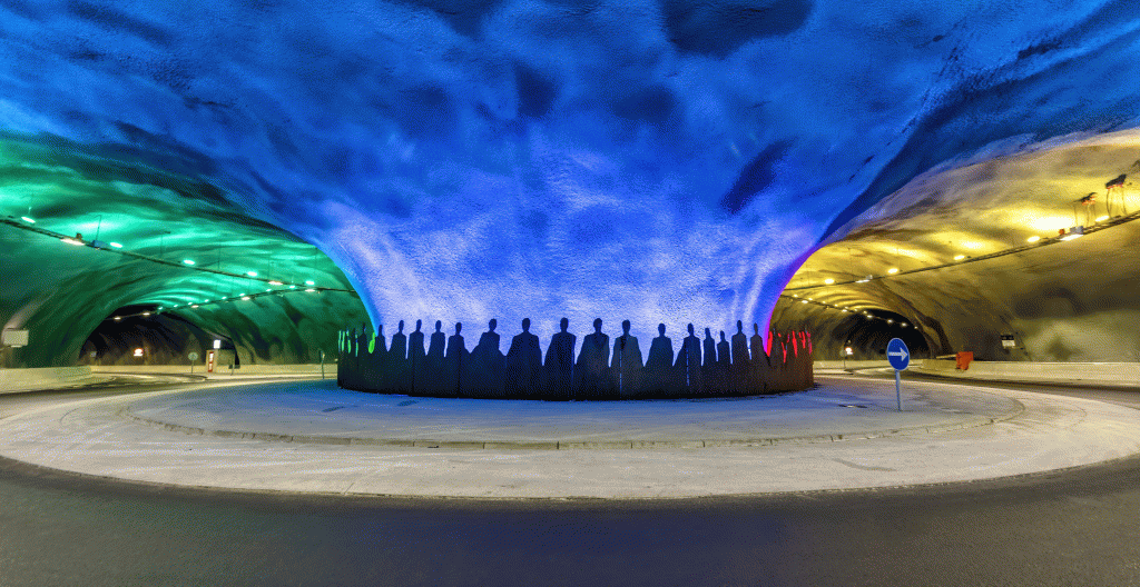
The Eysturoyar tunnel is a two-laned undersea tunnel that has three tubes which meet 72,6 metres below the surface at the world’s first, and only, undersea roundabout!
Aside from this unique feature, the appearance is striking looking like a giant jellyfish, illuminated with shifting aquamarine lighting and surrounded by life-size dancing figures symbolizing the traditional Faroese chain dance.
The tunnel passages are handled digitally with camera operated license plate registration and will be registered automatically to the car rental invoice at the end of the rental at these prices.
This map shows the locations of the tunnels and the passage costs. See map.
When self-driving in the Faroe Islands, always check the weather forecast, road conditions, and the opening hours of attractions, as they can be affected by the unpredictable climate. Additionally, drive cautiously and respectfully on narrow roads and be aware of wildlife on the roads, especially in rural areas. Enjoy your memorable adventure on our beautiful islands!